Careysburg District (Careysburg)
Careysburg District is one of four districts located in Montserrado County, Liberia. Bensonville is the capital, and the total district population is 28,463.
The city of Careysburg was first settled in 1856 by freed slaves from the United States and Barbados. The location away from the Liberian coast was chosen for health reasons, because of the high death rate due to mosquito-spread diseases among early settlers on the coast. Careysburg was named for former American Rev. Lott Carey.
Among Careysburg's natives was Bennie Dee Warner, who served as Vice President from 1977 to 1980.
Map - Careysburg District (Careysburg)
Map


Country - Liberia
 |
 |
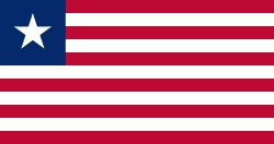
| Flag of Liberia | |
Liberia began in the early 19th century as a project of the American Colonization Society (ACS), which believed black people would face better chances for freedom and prosperity in Africa than in the United States. Between 1822 and the outbreak of the American Civil War in 1861, more than 15,000 freed and free-born African Americans, along with 3,198 Afro-Caribbeans, relocated to Liberia. Gradually developing an Americo-Liberian identity, the settlers carried their culture and tradition with them. Liberia declared independence on July 26, 1847, which the U.S. did not recognize until February 5, 1862.
Currency / Language
| ISO | Currency | Symbol | Significant figures |
|---|---|---|---|
| LRD | Liberian dollar | $ | 2 |
| ISO | Language |
|---|---|
| EN | English language |